Scott Pruitt, President Trump’s nominee to lead the Environmental Protection Agency, has a penchant for making misleading claims about his record on the environment.
A compelling example comes from Pruitt’s time as an Oklahoma state senator. In February 2002, Representative Mark Liotta wrote a bill to address the widespread problem of water pollution from chicken manure generated by factory poultry farms. Phosphorus, the primary pollutant in poultry manure, can trigger toxic algae blooms, threatening rivers, lakes and other waterways.
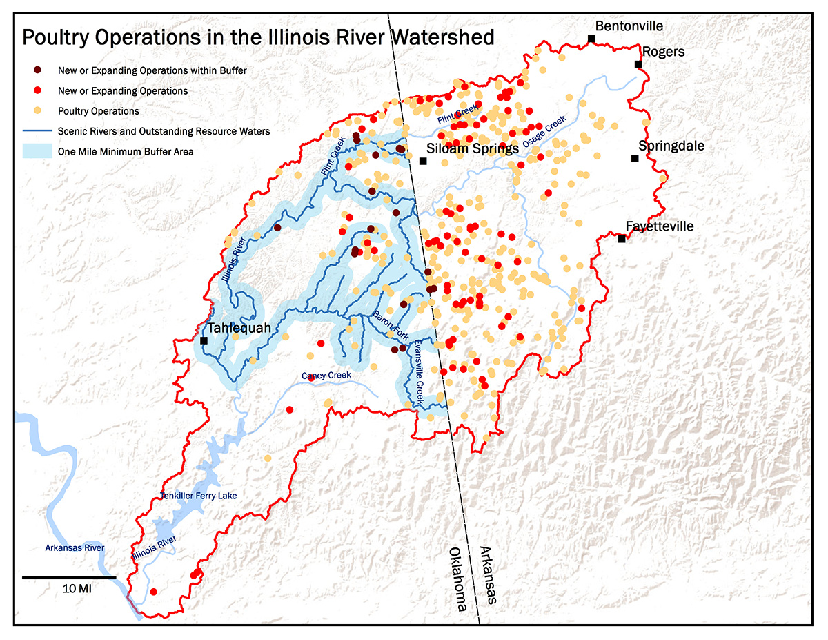
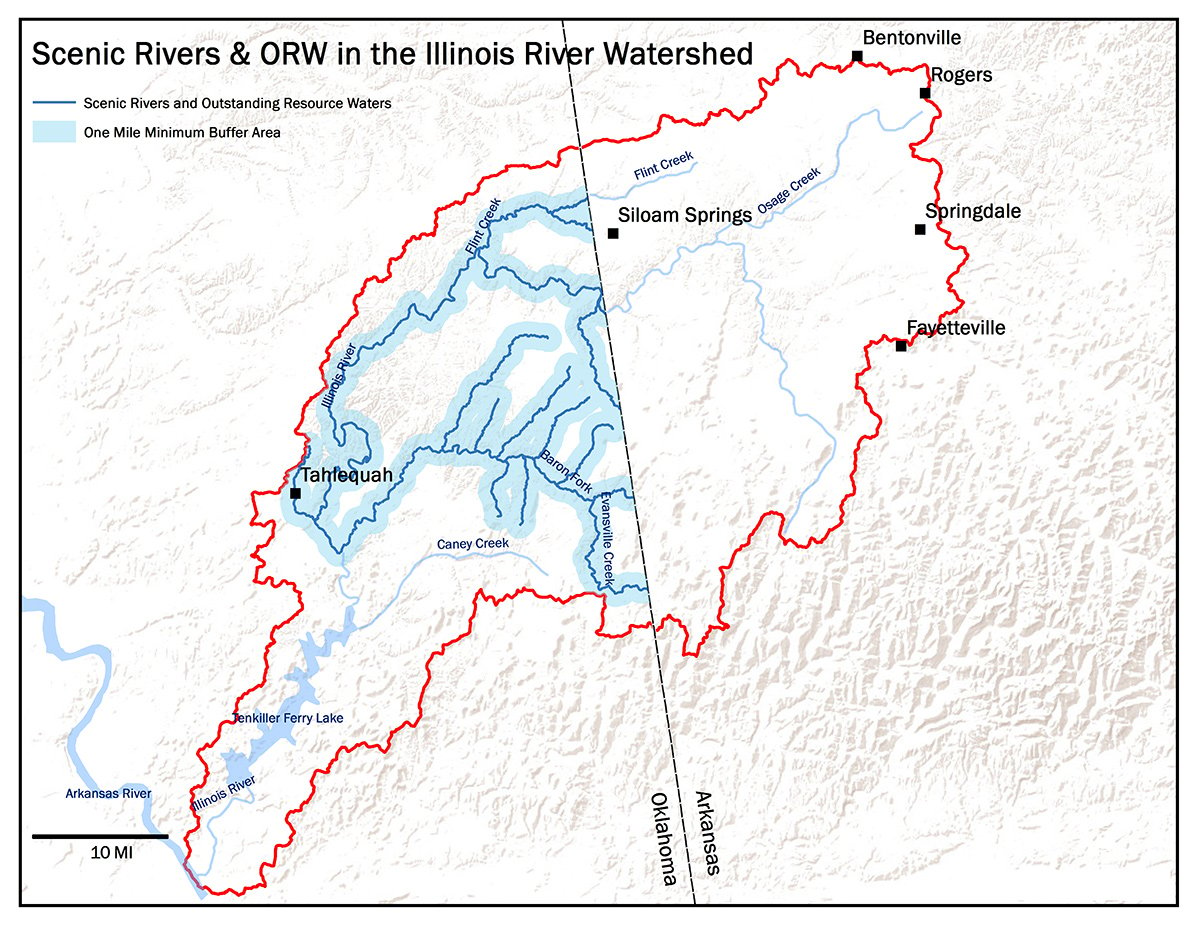
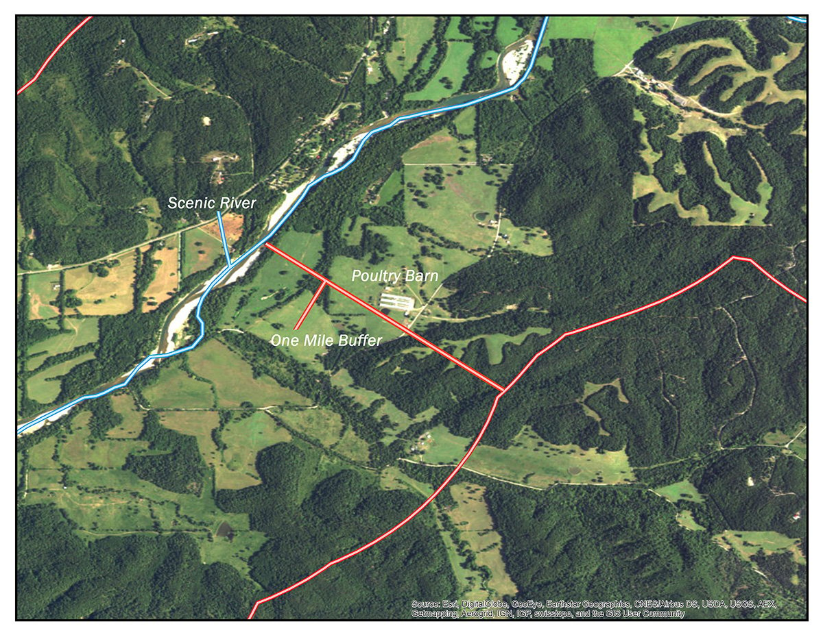
Liotta's bill would have restricted new or expanding poultry operations within a 100-year flood plain or within defined buffer zones, including within 1.5 miles of a state scenic river or outstanding resource water. The Illinois River, which flows from Arkansas into Oklahoma, carries both designations. The proposed legislation would have also prohibited spreading chicken manure on land within the buffer zones.
But by April 2002, Pruitt co-sponsored an amended version of the legislation, which was substantially weakened.
- It no longer prohibited land application of poultry waste in buffer zones, but instead merely required poultry operations to have a plan for managing the waste.
- It reduced the buffer zones around scenic rivers and outstanding resource waters to one mile.
- Most significantly, Pruitt's bill only placed limits on new or expanded poultry operations by out-of-state corporations – a gaping loophole because corporations don’t usually build feeding operations, local farmers do. Corporations own the chickens and enter into contracts with local farmers.
Despite these flaws, Pruitt boasted about the bill.
“[We] want [poultry operations] to occur in an environmentally safe way that doesn't threaten the water quality of northeast Oklahoma,” he said in an interview with KOTV-TV of Tulsa, Okla.
A look at the Illinois River watershed today shows that the law had little beneficial effect on Oklahoma’s environment.
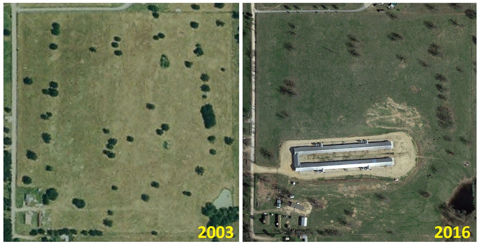
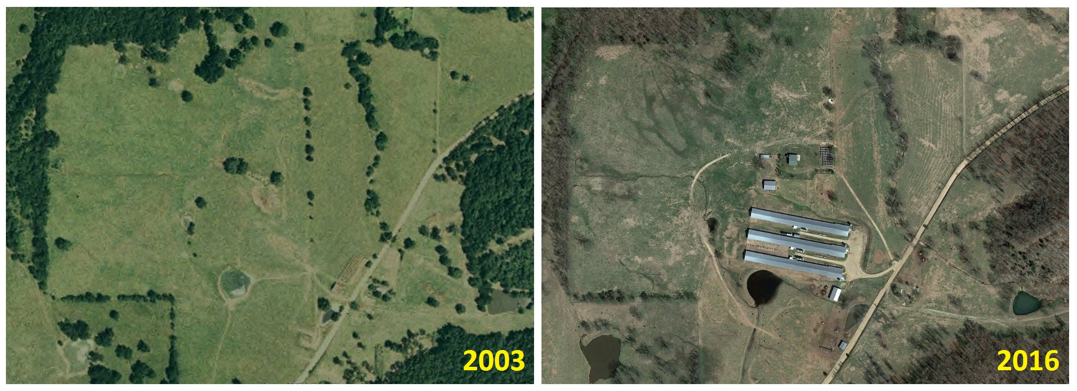
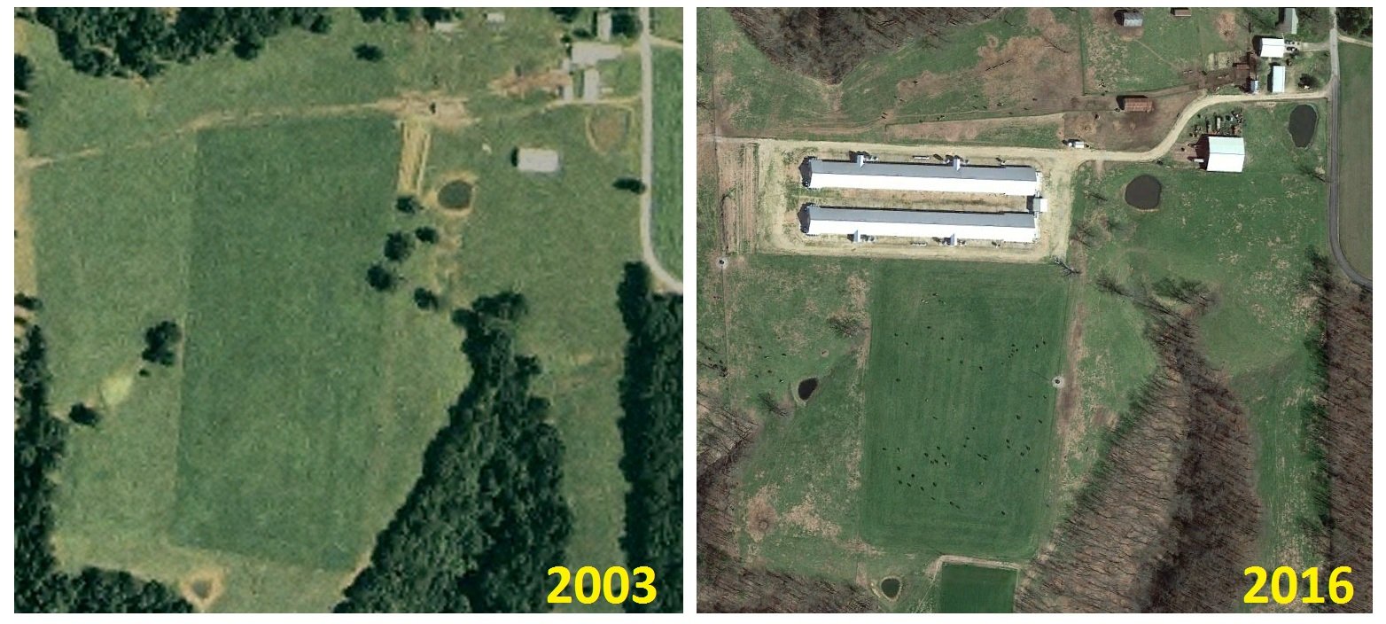
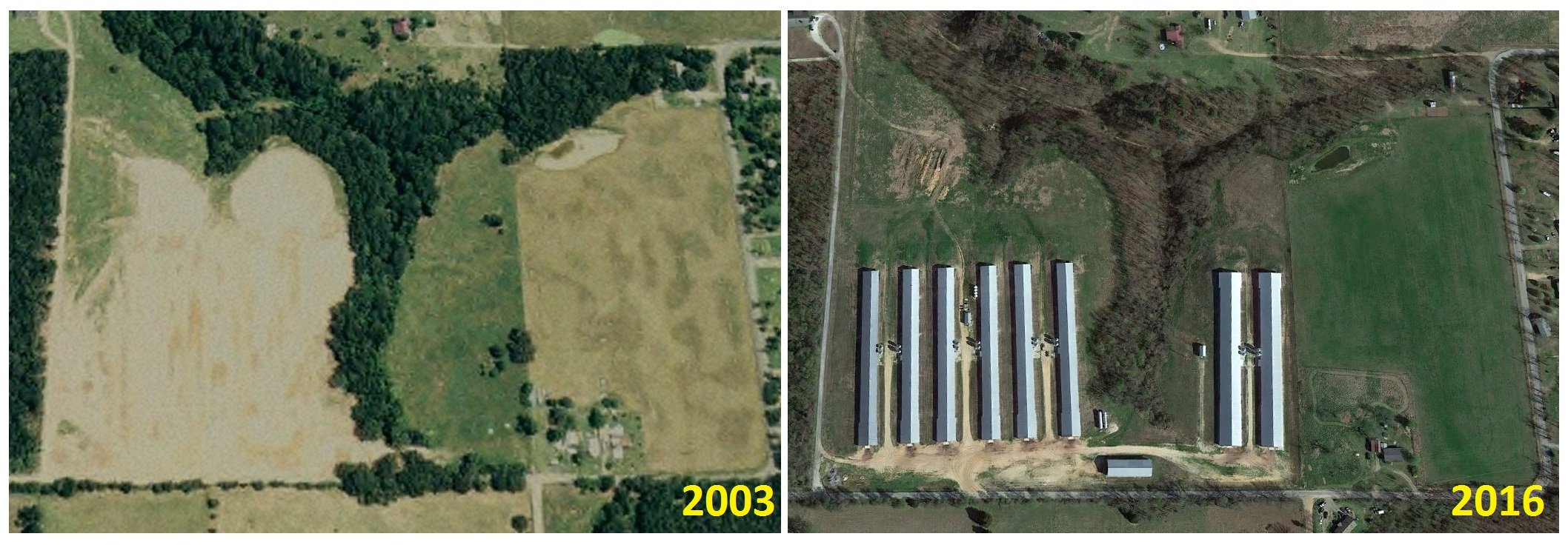
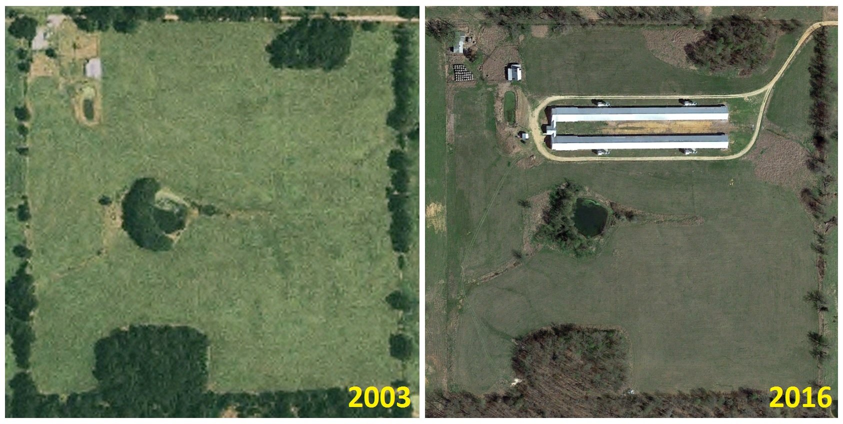
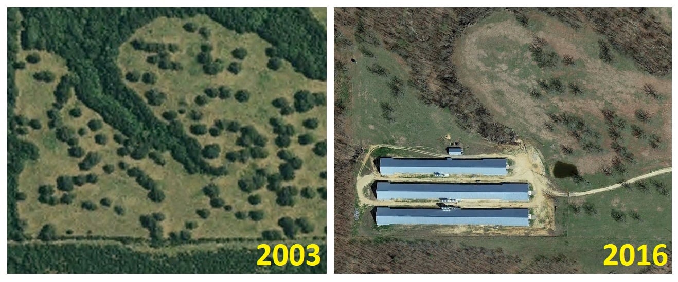
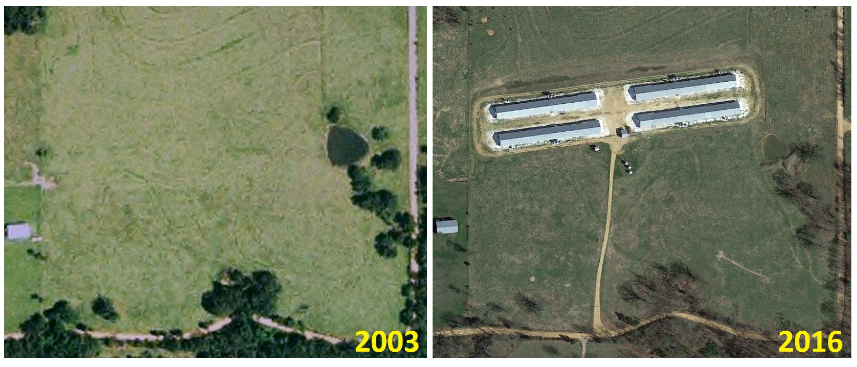
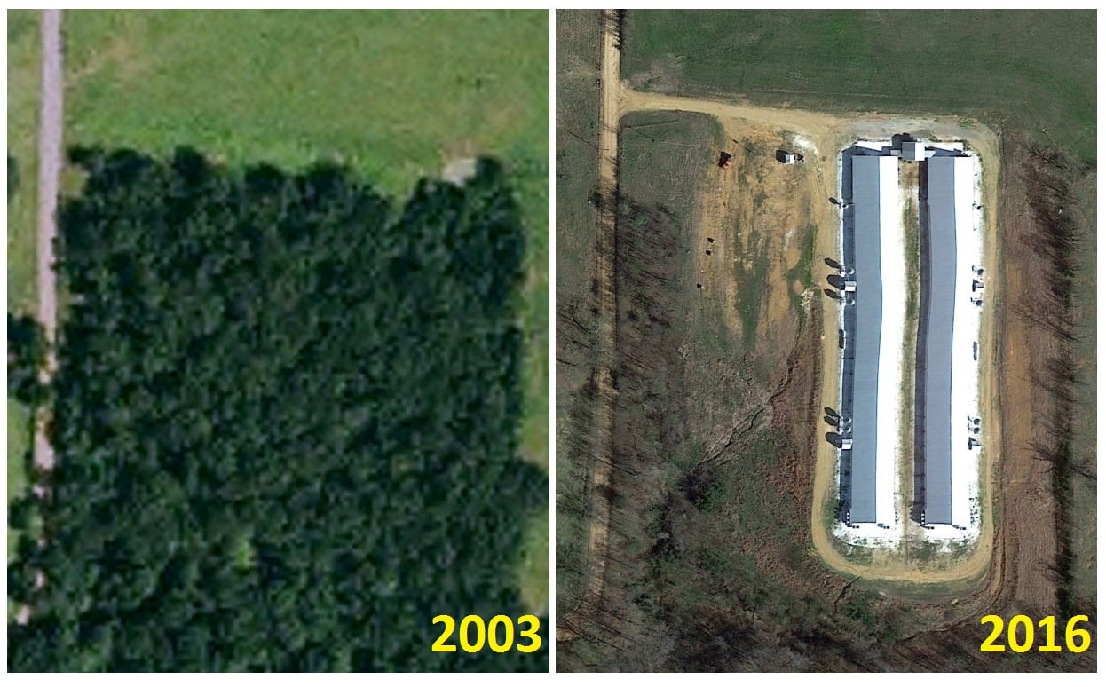
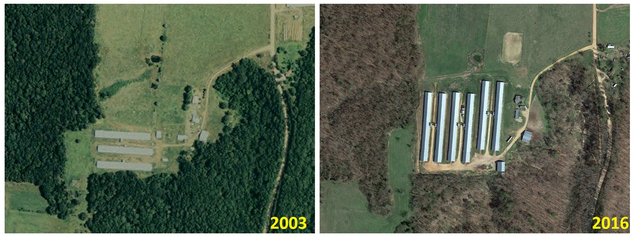
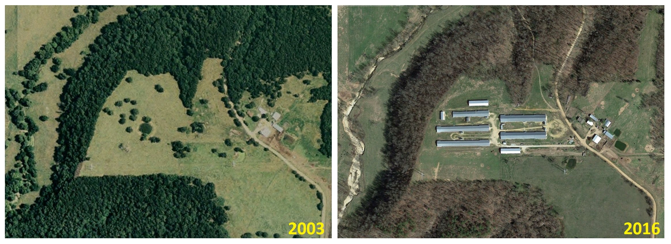
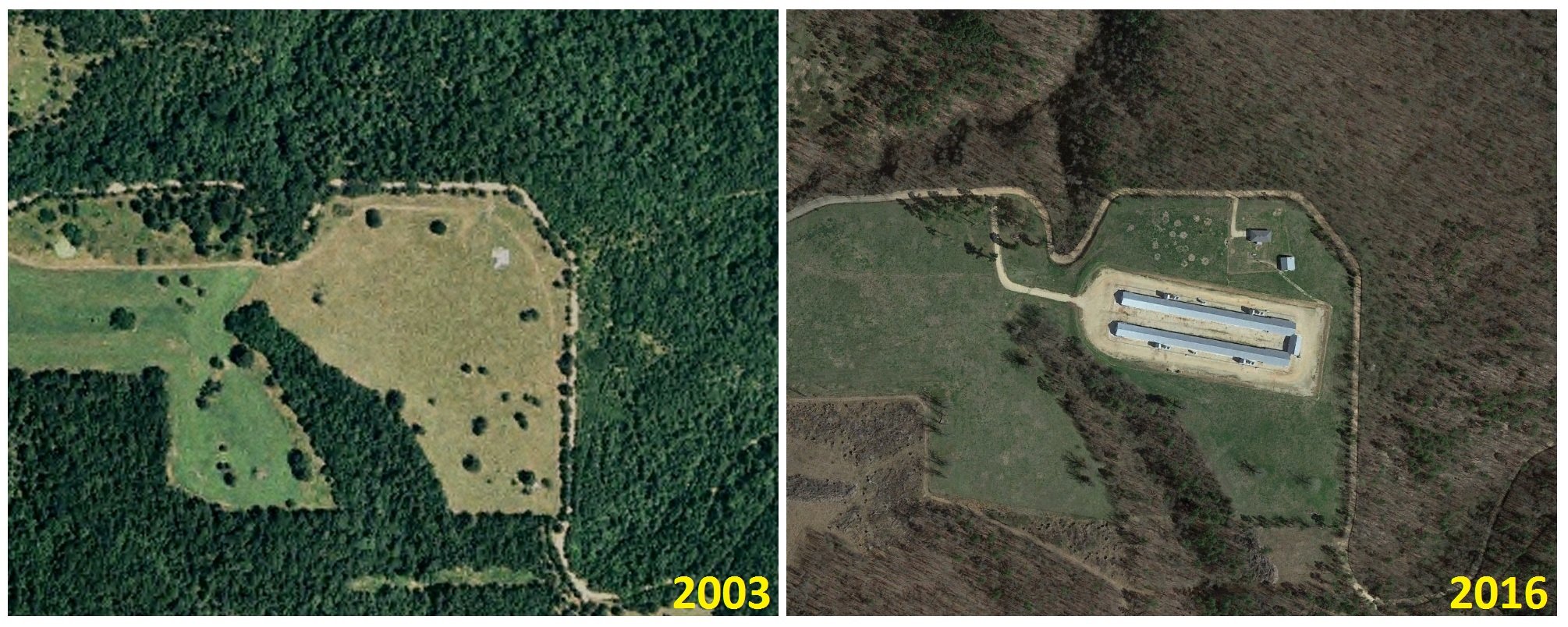
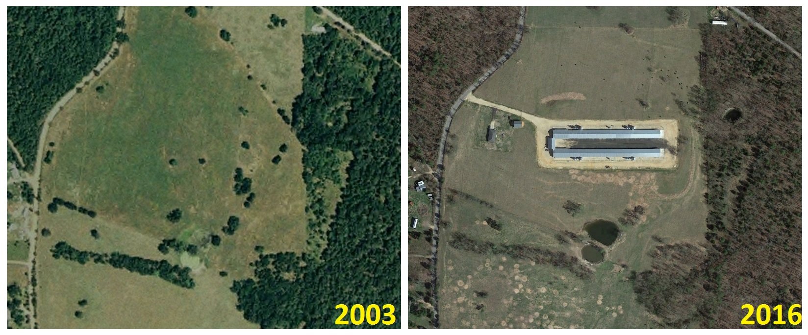
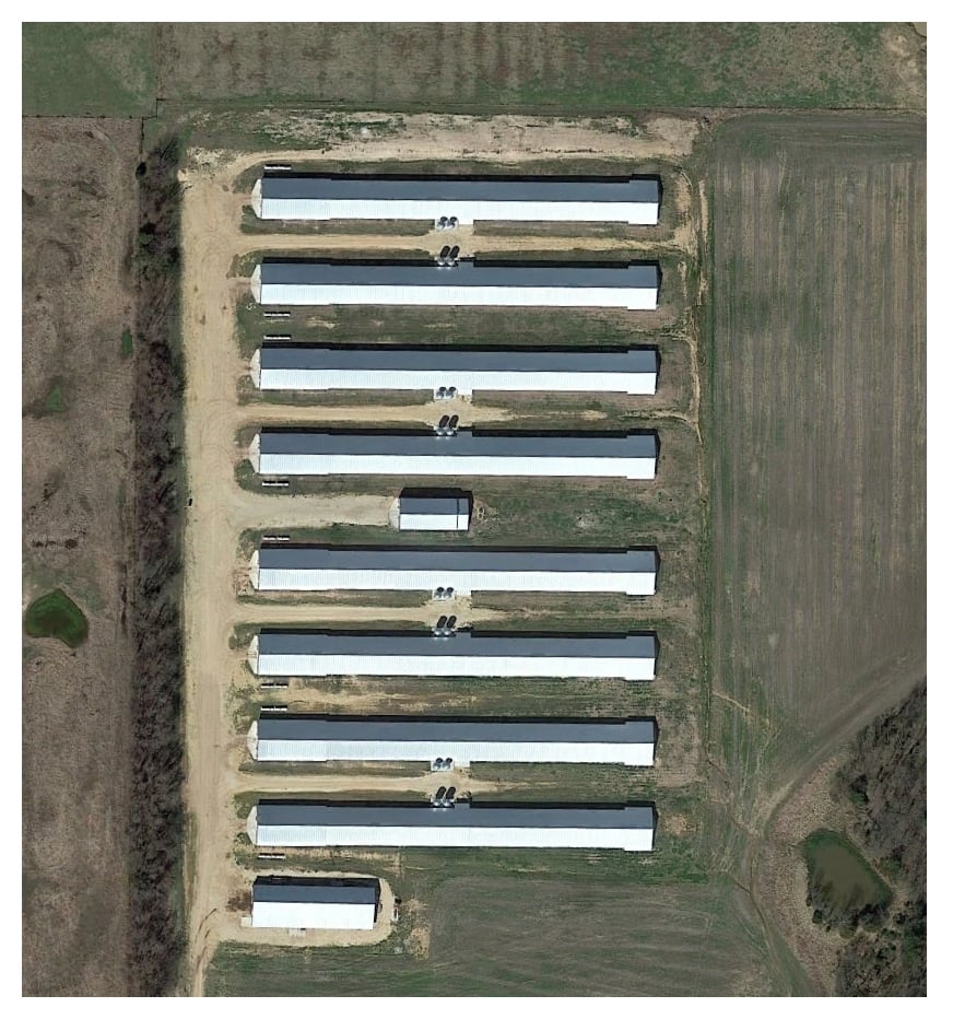
Using aerial photos from Google and the U.S. Department of Agriculture’s National Agricultural Imagery Program, EWG analysts found 14 new or expanded factory chicken farms established within a mile of a scenic river or outstanding resource water. In total, the new and expanded operations created a net increase of 33 new poultry barns between 2003 and 2016.
Source: Google Earth Imagery & USDA National Agricultural Imagery Program
Aerial photos comparing sites between 2003 and 2016 are available here.
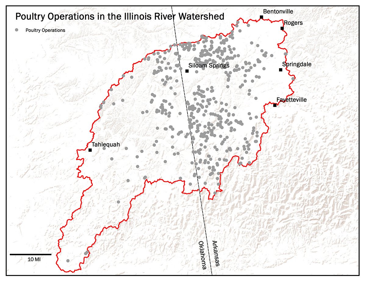
Analysts scanned over 1,600 square miles of aerial photos of the Illinois River watershed on both sides of the Oklahoma-Arkansas state line, identifying 112 poultry operations with 449 barns in Oklahoma. Results were then compared to images from 2003 and 2013 to determine if the operation had previously existed, was newly created or had expanded.
Either these new or expanding operations fall within the exemptions built into the weakened law, or Pruitt’s office failed to enforce the law.
EWG’s search of court and administrative filings found no evidence that Pruitt attempted to investigate or sanction these poultry operators while serving as attorney general from 2011 to 2016. EWG also filed an open records request with the Oklahoma attorney general’s office for documents on enforcement actions by the office and its communications about enforcement with the state Department of Agriculture, Food and Forestry, and other agencies, but has not yet received a response.
It's another example of Pruitt holding something up as an environmental victory that, upon further examination, doesn't hold water. In the case of protection of the Illinois River, this has become a key question in Pruitt’s nomination.
In his testimony before the Senate Environment and Public Works Committee, Pruitt sought to characterize a 2013 agreement as a historic effort to clean up the river, which is threatened by hundreds of thousands of tons of manure from millions of chickens raised in factory farms.
But the agreement developed by Pruitt and his Arkansas counterpart actually gave polluters more time to meet cleanup goals for the Illinois River and suspended any enforcement action by the attorney general’s office. In addition, Pruitt closed the attorney general’s Environmental Protection Unit and declined to pursue litigation against poultry companies polluting the river after poultry industry interests donated $40,000 to his 2010 campaign.
More details on EWG’s methodology and additional maps are available here.
2003 - 2016 Site Comparisons
Source for all images: Google Earth Imagery & USDA National Agricultural Imagery Program

